BLM and Forest Service to host Public Scoping Meetings for Bears Ears National Monument Management Plan
On December 4, 2017, President Donald Trump signed Proclamation 9681 modifying the Bears Ears National Monument designated by Proclamation 9558 to exclude from its designation and reservation approximately 1,150,860 acres of land, which lands are not covered by this Notice of Intent and will continue to be managed under the governing Monticello Record of Decision and Approved Resource Management Plan and Manti La-Sal National Forest Plan until they are otherwise revised or amended.
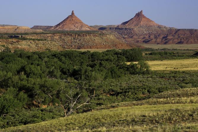
The revised BENM boundary includes two units known as the Shash Jáa and Indian Creek Units that are reserved for the care and management of the objects of historic and scientific interest within their boundaries. Proclamation 9558, as modified by Proclamation 9681, requires the BLM and the USFS to jointly develop a MMP. Each agency will continue to manage their lands within the monument pursuant to their respective applicable legal authorities.

To ensure that management decisions reflect tribal expertise and traditional and historical  knowledge, Proclamation 9558, signed on December 28, 2016, established a Bears Ears Commission to provide guidance and recommendations on the development and implementation of a management plan for the Bears Ears National Monument.
Proclamation 9681 modifies Proclamation 9558 and clarifies that the Bears Ears Commission shall be known as the Shash Jáa Commission, and shall apply only to the Shash Jáa Unit. The Commission consists of one elected officer each from the Hopi Nation, Navajo Nation, Ute Mountain Ute Tribe, Ute Indian Tribe of the Uintah Ouray, and Zuni Tribe, designated by the officers’ respective tribes, and the elected officer of the San Juan County Commission representing District 3 acting in that officer’s official capacity.
 The purpose of the public scoping process is to determine relevant issues that will inform the scope of the environmental analysis, including alternatives, and guide the planning process. Preliminary issues for the planning area have been identified by BLM and USFS personnel; Federal, State, and local agencies; and other stakeholders. These preliminary issues include cultural and historic resources, including protection of Indian sacred sites and traditional cultural properties; paleontological resources; travel management; livestock grazing; wildlife; vegetation and fire management; outdoor recreation; and other resource management.
Preliminary planning criteria include:
(1) The public planning process for the MMPs will be guided by Proclamation 9558 as modified by Proclamation 9681 in addition to FLPMA, NFMA, and NEPA.
(2) The BLM and USFS will use current scientific information, research, technologies, and results of inventory, monitoring, and coordination to determine appropriate management.
(3) The BLM and USFS will strive to coordinate management decisions with other adjoining planning jurisdictions, both Federal and non-Federal.
(4) Decisions made in the planning process will only apply to BLM-managed lands, National Forest System Lands, and, where appropriate, split-estate lands where the subsurface mineral estate is managed by the BLM.
(5) Existing Wilderness Study Areas (WSAs) will continue to be managed to prevent impairment and ensure continued suitability for designation as wilderness. Should Congress release all or part of a WSA from wilderness study, resource management will be determined by preparing an amendment to the MMP.
(6) The BLM will consider changes to the off-highway vehicle (OHV) area designations approved through the Monticello Field Office Record of Decision and Approved Resource Management Plan.
(7) As required by the Proclamations, the BLM and USFS will meaningfully engage with the Shash Jáa Commission and will carefully and fully consider integrating the traditional and historical knowledge and special expertise of the Commission for the Shash Jáa Unit. The BLM and USFS will also work with the Commission to identify parameters for continued meaningful engagement that will be set forth in the MMP.
You may submit comments on issues and planning criteria in writing to the BLM at any public scoping meeting, or you may submit them to the BLM using one of the methods listed in the Contact Information section (at left). To be most helpful, and to ensure inclusion in the Draft EIS, you should submit comments prior to the close of the 60-day scoping period (March 19, 2018) or 15 days after the last public meeting, whichever is later. Before including your address, phone number, email address, or other personal identifying information in your comment, you should be aware that your entire comment—including your personal identifying information—may be made publicly available at any time. While you can ask us in your comment to withhold your personal identifying information from public review, we cannot guarantee that we will be able to do so.
The BLM and USFS will evaluate identified issues to be addressed in the plans, and will place them into one of three categories:
1. Issues to be resolved in the plans;
2. Issues to be resolved through policy or administrative action; or
3. Issues beyond the scope of these plans.
The BLM and USFS will provide an explanation in the Draft MMPs/Draft EIS as to why an issue was placed in category two or three. The public is also encouraged to help identify any management questions and concerns that should be addressed in the plans.
The BLM and USFS will work collaboratively with interested parties to identify the management decisions that are best suited to local, regional, and national needs and concerns.
The BLM and USFS will utilize and coordinate the NEPA scoping process to help fulfill the public involvement process under the National Historic Preservation Act (54 U.S.C. 306108) as provided in 36 CFR 800.2(d)(3). The information about historic and cultural resources within the area potentially affected by the proposed action will assist the BLM and USFS in identifying and evaluating impacts to such resources.
The BLM and USFS will consult with Indian tribes on a government-to-government basis in accordance with Executive Order 13175 and other policies. Tribal concerns, including impacts on Indian trust assets and potential impacts to cultural resources, will be given full consideration consistent with these authorities and policies. Federal, State, and local agencies, along with tribes and other stakeholders that may be interested in or affected by the proposed action that the BLM and USFS are evaluating, are invited to participate in the scoping process and, if eligible, may request or be requested by the BLM and USFS to participate in the development of the environmental analysis as a cooperating agency.
The BLM and USFS will use an interdisciplinary approach to develop the plans in order to consider the variety of resource issues and concerns identified. Specialists with expertise in the following disciplines will be involved in the planning process: Rangeland management, minerals and geology, forestry, outdoor recreation, archaeology, paleontology, wildlife and fisheries, lands and realty, hydrology, soils, sociology, and economics.
Below is the public meeting notice with dates and locations. Please remember these meetings are a time for constructive dialog. It has already been established that some things are so well protected that it is a waste of time to discuss “what ifs” There is no if.
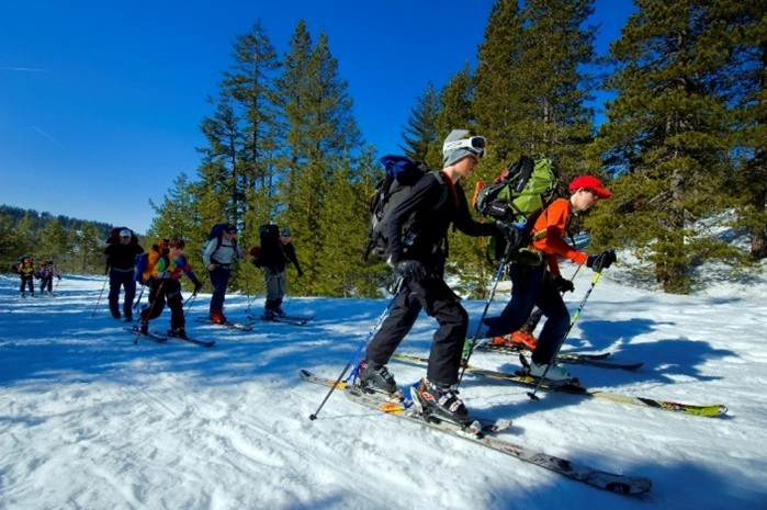
What is, is a look at things like hunting and fishing access. The chance to hike or camp in a scenic location. Should campgrounds be created? If so what kind and who would run them. Should roads be built maintained, or restored? If so, what kind of road would be best? Gravel? Paved?
Now that this is a reality, the logical step is to thoughtfully discuss what actions will best serve the needs of every stakeholder involved.
Related Posts
10 Tips For Winter Camping